Road map of Mauritius
with updates
The easiest way for exploring my island is a Globetrotter road map of Mauritius together with a Google digital map. And that’s not all …
Sometimes a highway or primary road is closed for repairs so you can well imagine the delays on a small island. The answer is all here because I’ll keep you informed with road updates on this page. You can then plan your itineraries accordingly.
Who wants to be stuck in traffic whilst on holiday?
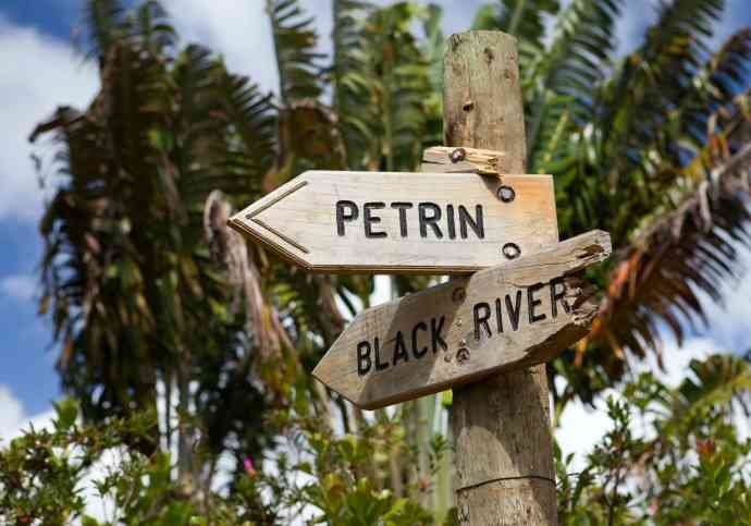
I’ll also show you how to navigate our nameless seaside roads. At times you won't need a map just follow these charming vintage road signs …
The best road map of Mauritius is …
For me the Mauritius Globetrotter road map is the best for driving around the island. They are easy to read and show places of interest. Plus ...
They won’t mind a bit of sand or a few drops of our delicious rum cocktail while plotting your itinerary languidly lying on the beach … Am sure you'll agree it's a great advantage. Make sure you order the new version.
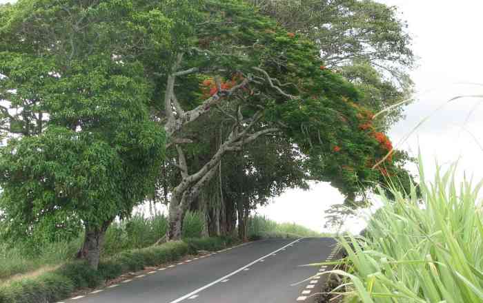
A primary road with her beautiful scenery

Road map of Mauritius
The thick lines you see on the Google map represent our 2 highways.The M2 connects the airport in the South to Port Louis our capital in the North West and all the way to Grand Bay in the North.
A new link freeway bypasses busy Port Louis from Verdun to Terre Rouge. A great time saving.

I have shown road diversions with a red triangle. You can jump down to road repairs updates by clicking here.
How to find your way when streets have no names?
Off you go with a road map and a digital map ready to travel all over our island. Things are not as straightforward as they seem because …
- Our primary roads have a reference number and no name
- Our secondary roads don’t have names except for the odd ones
- Our main city roads are all called ‘Royale Road’
All this could a little confusing ...
When you need to find your holiday accommodation ask for directions. You will be told something like ‘ turn right after the post office, then turn left when you see two coconut trees in front of a low wall’…
We more or less know where everyone lives in our area so if you get lost in the maze of small seaside roads simply ask the first person you see for directions.
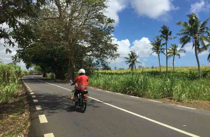
Travel around the island and explore our beautiful country. You can see where you are from almost anywhere. It could be a mountain or the sea. The only exception is before cane cutting season when both sides of some roads are lined by sugar cane which means your view is partially blocked for a while.
Click here for advice from an ‘old hand’ at driving to all four corners of the island.
Distances on the road map can be misleading
Especially in the case of Mauritius. Although the island is only 45 km wide and 65 km in length you’ll sometimes take longer than expected to reach your destination. Why? Our primary roads are narrow with two lanes.
We have a popular bus service. You could get stuck behind a bus for a while or behind a vehicle driven by one of our numerous slow drivers.
Tip:
You will block the traffic if you stop on a primary road to consult a map. So it’s a good idea to memorize the direction and the name of your destination before you set off.
Download a Google map for offline use
It’s free and convenient when you need to consult your digital map and there is no internet connection or GPS.
Zoom in your downloaded map for a detailed look at the streets. This is how we used to navigate before maps became more sophisticated with directions, satellite and 3 D views.
At the moment Google will keep your saved maps for 30 days.
Please note you can't rely entirely on GSP because the software cannot keep track of the constant changes with our roads.
With road map of Mauritius and a Google digital map you’ll be well equipped for directions.
Updates on road repairs
Beginning 2015
Cracks started to appear on the link highway which bypasses Port Louis between Terre Rouge and Verdun. The freeway is closed to traffic. You now have to drive through busy Port Louis to reach the North.
February 2015
A temporary road is being built to bypass the damaged part of the freeway.
April 2015
The diversion road is open to traffic from 6 am until 6 pm. Speed limit is 40km per hour. You can now give Port Louis a miss.
January 2016
The freeway has been repaired.
March 2018
The freeway is being repaired (again). Use the diversion road which is closed at night time.
In any case you should avoid Port Louis during peak hours. That’s until 9 30 am in the morning and from 3 pm until 6 pm in the afternoon. Sundays are plain sailing.
Related Pages


Home < Mauritius maps < road map of Mauritius
I'd love to hear from you - add your questions or comments below!

Bonjour! I'm Marie-Christine. Your new friend in Mauritius...
I've created this website to help and guide you! Take your time. Browse. There's information here you won't find anywhere else!
Visitor Top Pages

Quotes From My Visitors
Thank for your beautiful guide on line.... better than lonely planet!!! Ciao.
Silvano R. Bari, Italy
Your website has been like an oasis in a desert.. .it's been the most useful that I have come across after hours of trawling.
Leanne M. Colchester, UK
I really appreciate your advice more than you know... Thanks again for your wonderful website, it is by far the best one I have visited and I was so excited when I found it!
Cecilia. H Ballito, South Africa
Just a few words from Bath, England, to thank you for putting together such a lovely website!
I have enjoyed reading the pages and have shared it with all the others so they can whet their appetite's and look forward to visiting. it is so nice to visit a straightforward website without too much clutter, that gives people what they are looking for in such a lovely way.
People may take time to complain, but don't often write with praise, so I want to correct that imbalance!
Ian K. Bath, UK
Thank you for your well documented and informative web-site. It's a fascinating feast of information of such a beautiful island.
Louis B. Stellenbosch, South Africa
Your website is such a wonderful help to families like mine planing a trip to the island for the first time. Travel agents tend to direct us to the fantastic properties occupying strips along the coastlines, but i'm keen for my family to have a local experience.
Meenal J. Aberdeen, UK